CartaLinx The Spatial Data Builder. Digital map development tool designed as a companion to GIS and desktop mapping products. http://www.clarklabs.org/ Clarklabs.org~Site InfoWhoisTrace RouteRBL Check
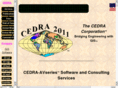
CEDRA Corporation Provides services for the conversion of hardcopy drawings into digital form along with database and application development. Maps and drawings can be converted into vector or raster digital format. Description of software and application examples. http://www.cedra.com/ Cedra.com~Site InfoWhoisTrace RouteRBL Check
Interlis Freely available specifications and information about software and projects. Standard tool for communication between users and systems and serves as a link between UML and XML. http://www.interlis.ch/ Interlis.ch~Site InfoWhoisTrace RouteRBL Check
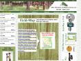
Field-Map Technology for computer aided field data collection. It combines flexible real-time GIS software with electronic equipment for mapping and dendrometric measurement. http://www.fieldmap.cz/ Fieldmap.cz~Site InfoWhoisTrace RouteRBL Check
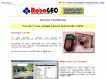
RoboGEO Windows software that will georeference images with the GPS latitude, longitude and altitude data by stamping them and by writing to the JPG EXIF headers. http://www.robogeo.com/home/default.asp Robogeo.com~Site InfoWhoisTrace RouteRBL Check
Distancies This page calculates automatically the distance between two cities using their latitudes and longitudes on the planet. The program extrapolate the data to an ellipsoidal sphere with the same parameters of Earth and then calculate the distance. http://www.geocities.com/distancies/ Geocities.com~Site InfoWhoisTrace RouteRBL Check